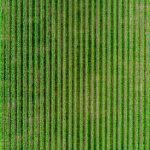
Satellite images from a vast distance can capture a wide-angle viewing zone, making artificial intelligence more effective in a range of fields. Furthermore, AI systems that employ satellite images may learn to foresee different circumstances after analyzing the situation with satellite imaging datasets created particularly for AI models. Furthermore, a considerable quantity of … [Read more...] about How to Perform Quality Check on Agriculture Satellite Imagery Dataset
satellite
International Conference on Artificial Intelligence
Artificial intelligence (AI), the ability of a digital computer or computer-controlled robot to perform tasks generally associated with'intelligent'beings. The term is often applied to the project of developing systems endowed the intellectual processes characteristic of humans, just like the flexibility to reason, discover meaning, generalize, or learn from previous … [Read more...] about International Conference on Artificial Intelligence
LEO Technology and Satellite Internet: How Innovation is Disrupting the Industry and Improving Connectivity
In years past, satellite broadband service has been synonymous with a last-resort pull to receive a signal in an underserved area where it's often difficult to access the internet or watch cable television otherwise. The solution was accompanied by a clunky satellite dish that sat on the roof and had to be positioned in precisely the right angle to enable even fuzzy, unreliable … [Read more...] about LEO Technology and Satellite Internet: How Innovation is Disrupting the Industry and Improving Connectivity
Dark Matter: How GPS Data is Helping to Unlock the Universe’s Secrets
Data is essential to the way we live our lives here on Earth. But its also proven to be very helpful in exploring the mysteries of the universe beyond our tiny planet. Because there are so many phenomena observed in space that are difficult to measure, many mysteries remain about how the universe functions, changes, and evolves. Dark matter has been of particular interest to … [Read more...] about Dark Matter: How GPS Data is Helping to Unlock the Universe’s Secrets
10th International GIS-Forum
SOVZOND Company is'excited to announce and invite you for the participation in 10th'anniversary'edition of International GIS-Forum''Integrated geospatial solutions the future of Information Technologies', a unique meeting place and must-attend event for geospatial community. The event will take place on'13-15 April, 2016'in IMPERIAL Park Hotel, Moscow, Russia. The event … [Read more...] about 10th International GIS-Forum


