Infrastructure mapping across the UK, from highways and railways to utilities and public works, has long faced the challenge of incomplete, outdated or fragmented data. Traditional surveys and planning records may not keep pace with rapid urban expansion, climate-driven changes, or the dense tangle of buried networks. Edge computing offers a new paradigm: by equipping drones, … [Read more...] about Bridging UK Infrastructure Data Gaps with Edge and Distributed Sensing
drones
Revolutionizing Palm Oil Plantations: How AI and Drones are Cultivating Efficiency and Sustainability
The Pressing Need for Innovation in Palm Oil Agriculture The global demand for palm oil, a ubiquitous ingredient in countless consumer products and a vital biofuel source, continues to surge. However, traditional large-scale palm oil plantation management is fraught with challenges. These operations are often labor-intensive, struggle with optimizing resource allocation, and … [Read more...] about Revolutionizing Palm Oil Plantations: How AI and Drones are Cultivating Efficiency and Sustainability
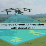
Improving Drone AI Capabilities through Visual Data Annotation
AI-powered drones might be stealing headlines for their futuristic capabilities, but the real power lies in the silent technology that fuels their intelligence, i.e., computer vision and machine learning. From facilitating object detection to crop monitoring and self-navigation, drones rely on training data to "learn" and "understand" their surroundings. Without it, even the … [Read more...] about Improving Drone AI Capabilities through Visual Data Annotation
DroneX
DroneX offers unparalleled coverage to UAV professionals that are looking to enhance their offering through the latest innovative solutions. The show is set to bring you the latest products and technologies as well as showcase the advancements, trends, and sustainability within the sector.' ' That's not all, the show brings together like-minded professionals who all share the … [Read more...] about DroneX
The Role of Drones for Inspections
From a mechanical standpoint, drones are simple machines. From a practical and economical one, their simple construction and small footprints are disproportionate to the value they provide. Drones are hard to beat when it comes to inspecting structures and studying how humans impact the natural world. Here are a few ways drones play interesting roles in inspections and more … [Read more...] about The Role of Drones for Inspections


