
This course will cover the agricultural and urban water quality issues in Florida, their bases, land and nutrient management strategies, and the science and policy behind the best management practices (BMPs). Students will learn to evaluate BMP research and analyze its role in determining practices and policies that protect water quality. … [Read more...] about Sustainable Agricultural Land Management
Environmental Science and Sustainability
Global Arctic

The GlobalArctic MOOC introduces you the dynamics between global changes and changes in the Arctic. This course aims to highlight the effects of climate change in the Polar region. In turn, it will underline the impacts of a warmer Arctic on the planet Earth. For human civilization, the Arctic stands both as a laboratory and a warning for human kind. Besides, this course … [Read more...] about Global Arctic
Geospatial and Environmental Analysis
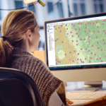
Apply your GIS knowledge in this course on geospatial analysis, focusing on analysis tools, 3D data, working with rasters, projections, and environment variables. Through all four weeks of this course, we'll work through a project together - something unique to this course - from project conception, through data retrieval, initial data management and processing, and finally to … [Read more...] about Geospatial and Environmental Analysis
The Effect of Fires on People, Property and the Environment

Fires impact people, property and the environment in all countries around the world. In some cases, the resulting losses are extraordinary, causing hundreds of deaths, widespread damage to property and contents and significant impacts on the environment. More often, fires may cause a single casualty or affect a single home, though the effects are still highly significant to … [Read more...] about The Effect of Fires on People, Property and the Environment
Fundamentals of GIS
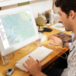
Explore the world of spatial analysis and cartography with geographic information systems (GIS). In this class you will learn the basics of the industry’s leading software tool, ArcGIS, during four week-long modules: Week 1: Learn how GIS grew from paper maps to the globally integrated electronic software packages of today. You will install ArcGIS on your computer and learn … [Read more...] about Fundamentals of GIS